

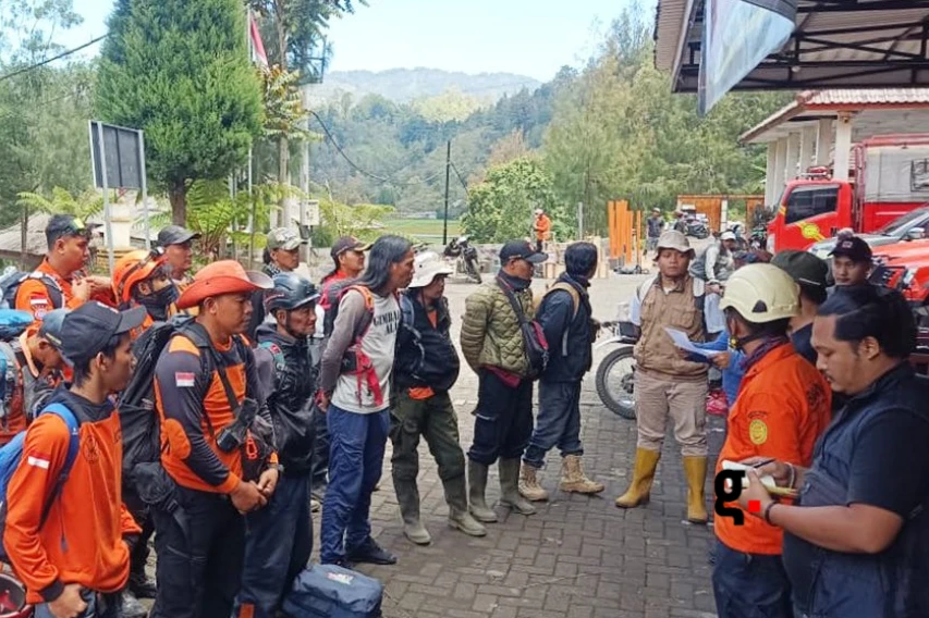
Lumajang Disaster Agency Urges Mount Semeru Climbers to Adhere to Safety Protocols Amid SAR Operation

LUMAJANG — The Regional Disaster Management Agency (BPBD) of Lumajang Regency has issued an urgent advisory calling on all Mount Semeru hikers to strictly utilize official trails, complete mandatory registration, and respect hazard boundary zones established by volcanological authorities.
The warning, issued on Monday (Nov 9), follows the ongoing joint Search and Rescue (SAR) operation for two missing hikers from Sidoarjo, identified by their initials BK and MWF (19), who disappeared in the volcanic complex.
Head of BPBD Lumajang, Isnugroho, emphasized that official trail registration is a non-negotiable safety procedure designed to enable real-time tracking of movement during mountain emergencies.
”Hikers must ensure they use official routes and complete registration at posts. This allows authorities to track their movements so emergency responses can deploy rapidly if needed,” Isnugroho stated in Lumajang, East Java.
Strategic Audit: Mount Semeru Emergency Response & Safety Framework
| Operational Pillar | SAR Deployment & Technical Assets | Institutional & Safety Directives |
|---|---|---|
| SAR Task Force Mobilization | 50 personnel deployed combining Basarnas, TNBTS National Park officers, BPBD, and volunteers | Joint search operation targeting 2 missing Sidoarjo hikers (BK and MWF, 19) |
| Aerial Thermal Search | Thermal imaging drones deployed to map high-altitude, difficult-terrain search grids | Complying with aviation protocols to cover remote volcanic slopes efficiently |
| Investigation & Evidence | Rented motorcycle linked to the victims recovered in agricultural area (Nov 6); verifying illegal trail use | Determining whether unapproved access routes were utilized to enter the restricted zone |
| Volcanological Mandates | Mandatory compliance with PVMBG volcanic hazard recommendations and TNBTS checkpoint registration | Preventing casualties during unpredicted volcanic activity and adverse alpine weather |
Thermal Drone Search and Illegal Trail Verification
The multi-agency search operation mobilizes around 50 personnel, combining squads from the National Search and Rescue Agency (Basarnas), the Bromo Tengger Semeru National Park (TNBTS) authority, BPBD, and local volunteer teams.
To navigate the steep, hazardous terrain, SAR teams deployed thermal imaging drones for aerial mapping and thermal signature detection along high-probability search grids.
Meanwhile, investigators are verifying whether the missing hikers bypassed official checkpoints via unauthorized access routes. A rented motorcycle belonging to the duo was discovered abandoned near a local agricultural field on Friday (Nov 6), supporting suspicions of unofficial entry.
BPBD Lumajang urged prospective hikers to prioritize safety over summit goals, reminding the public that alpine navigation, physical readiness, and strict adherence to PVMBG volcanic alerts are essential to prevent life-threatening incidents.